Son Tra Peninsula
Da Nang, Vietnam
Connectez-vous pour obtenir le dernier temps!
C'est gratuit de rejoindre Spedmo et de commencer à collaborer
Conditions actuelles
Pas d'alertes.
Rappelez-vous avant chaque vol, vérifiez votre équipement , réévaluez les conditions et demandez-vous si «je suis en sécurité »?
Obligatoire Lancer Direction du vent
Décollage
16.1179, 108.274 : 573.0 m
Zone d'atterrissage
16.1008, 108.257 : 6.0 m
lever du soleil
5:24 AM
Le coucher du soleil
6:22 PM
Fuseau horaire
heure d’Indochine (+0700)
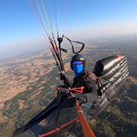
some pictures taken in recent trip to Son Tra flying site by Ha Noi Paragliding Club, http://www.flickr.com/phot...
573m ASL, can launch in 2 directions: East and South; thanks to Da Nang City support we - Ha Noi Paragliding Club - have renovated and clear a nice and wide area for preparation and take-off. The launch site is easily accessible by motorcycles and cars by newly completed asphalt pave road [see videos and pictures we made in recent trip to Son Tra flying site]. Coordinates: 16.1179 108.2738, Alt: 573 m, Timezone: ICT (UTC+7) THO QUANG beach, 2.5km below the take-off site, a long sand beach gives you plenty of spaces for nice and safe landing. Coordinates: 16.100768° 108.257243° a nice and wide asphalt paved road to the launch site is completed recently by Da Nang city, therefore the launch site can be easily accessed by motorcycles and cars. Restricted area: see picture in the link below, restricted area is marked by these 4 coordinates: 16005’00”N - 108013’40”E; 16002’50”N - 108013’40”E; 16002’50”N - 108012’25”E; 16004’18”N - 108012’25”E. - height limit: from ground level to 1500m high. - restricted time: 24/24 h of a day. http://www.danangrc.com/fo... Restricted area: see picture in the link below, restricted area is marked by these 4 coordinates: 16005’00”N - 108013’40”E; 16002’50”N - 108013’40”E; 16002’50”N - 108012’25”E; 16004’18”N - 108012’25”E. - height limit: from ground level to 1500m high. - restricted time: 24/24 h of a day. http://www.danangrc.com/fo...
Les personnes suivantes suivent activement les mises à jour de ce site.

